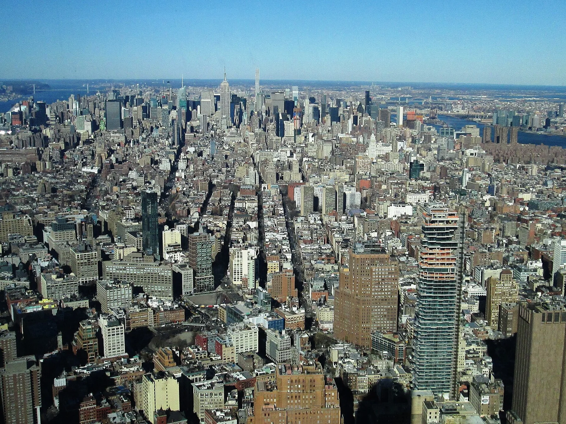
How Manhattan Streets and Avenues Work
Manhattan's grid becomes much easier once you separate the rule from the exceptions: numbered streets generally run across the island, avenues generally run north–south, Fifth Avenue separates East and West street names, and Broadway repeatedly cuts across the pattern.
Image: Beyond My Ken · CC BY-SA 4.0

The grid is a navigation tool, not a perfect rectangle
Most first-time confusion comes from expecting every part of Manhattan to behave like Midtown. The famous grid is strongest through much of the island north of Houston Street: numbered streets generally run east–west and the major avenues generally run north–south. Once you know that, a street number tells you roughly whether you are moving uptown or downtown, while changing avenues usually means you are moving east or west.
The grid has a historical reason. New York City's Municipal Archives notes that surveyor John Randel Jr. produced the Commissioners' Plan of 1811, imposing a regular system of streets and avenues from Houston Street north toward 155th Street. The modern city changed that plan in many places, but the underlying logic still explains why so much of Manhattan feels legible on foot.
Fifth Avenue is the East/West divider for numbered streets
On numbered cross streets, Fifth Avenue is the practical dividing line between East and West. East 42nd Street and West 42nd Street are not two unrelated roads: they are the east and west sides of the same numbered street, divided by Fifth Avenue. This is especially useful when reading an address because the street name already tells you which side of Fifth Avenue to head toward.
Do not apply that rule blindly downtown. Below the strongest part of the grid, older streets such as Wall, Pearl, Bowery and parts of Greenwich Village follow earlier patterns. Downtown navigation works better by watching actual street names and landmarks rather than trying to force Midtown logic onto the map.
Avenues are the long north–south framework
First Avenue is on the east side, and the numbered avenue sequence generally moves westward, but Manhattan also contains named avenues and avenue names that change by neighborhood. Park Avenue, Lexington Avenue and Madison Avenue interrupt a simple numbered sequence on the East Side. Farther west, some numbered avenues take neighborhood names in sections. That is why counting avenues works as an orientation shortcut, not as a substitute for checking the actual map.
Broadway is the useful exception you will notice most
Broadway cuts diagonally through large parts of the grid. Where it crosses major avenues, it creates recognizable spaces and unusual intersections. Instead of treating Broadway as a problem, use it as a clue: if your route suddenly stops looking rectangular, Broadway is often the reason.
For walking, street blocks and avenue blocks do not feel the same
A common planning mistake is assuming five blocks always means the same walking effort. Crosstown blocks between avenues are generally much longer than the short north–south blocks between numbered streets. So “two avenues over” can take more time than “five streets uptown.” The exact geometry varies, especially downtown and in Upper Manhattan, so use that as a planning instinct rather than a fixed conversion formula.
The fastest way to learn the system
Pick one anchor avenue, one cross street and the direction of your next destination. If you are at Fifth Avenue and West 42nd Street, for example, you already know which side of Manhattan you are on and whether the next numbered street takes you uptown or downtown. NYC DOT's WalkNYC maps use the same practical idea: orient the map to what a pedestrian sees and show nearby streets, landmarks, transit and estimated walking areas. After a few trips, Manhattan's grid becomes less a map you memorize and more a coordinate system you read while moving.
Methodology
This explainer was written as a navigation guide rather than a historical encyclopedia. Historical claims about the grid are anchored to New York City archival or landmark sources, while present-day pedestrian orientation is cross-checked against NYC DOT's WalkNYC system. The article deliberately uses words such as “generally” because Lower Manhattan, Greenwich Village, Broadway, parks and Upper Manhattan contain important exceptions. It avoids rigid block-to-minute formulas because block geometry, crossings, crowding and mobility needs vary by route.